Division 02 · Land Surveying

Licensed land surveying, under one roof.

Boundary, topographic, ALTA/NSPS, construction staking, and FEMA elevation certificates — performed under a Missouri Professional Land Surveyor and coordinated directly with our civil, structural, and geospatial teams.

Licensed Missouri Professional Land Surveyor on staff · Signed and sealed deliverables · Coordinated with our engineering team

See survey services →

/01

Boundary Surveys

Property line resolution, deed research, and monumentation performed under a Missouri Professional Land Surveyor.

  • Deed and title research
  • Field measurement and record recovery
  • Corner monumentation and witnessing
  • Boundary line agreements and disputes
  • Signed and sealed plat of survey

/02

Topographic Surveys

Field-verified elevations, features, and improvements to support engineering design and site planning.

  • Existing conditions mapping
  • Contour and spot elevation development
  • Utility location and coordination
  • Site feature and improvement location
  • Basemaps delivered CAD-ready for design teams

/03

ALTA/NSPS Land Title Surveys

Prepared to the current ALTA/NSPS standards for commercial real estate transactions and title work.

  • Current ALTA/NSPS Table A compliance
  • Title commitment review and easement plotting
  • Boundary and improvement location
  • Zoning classification and setback confirmation
  • Coordination with title, lender, and legal counsel

/04

Construction Staking & Layout

Field layout for grading, structures, utilities, and site improvements — coordinated directly with our engineering team when needed.

  • Rough and finish grading stakes
  • Building corner and slab layout
  • Utility, curb, and pavement layout
  • As-built verification and record documentation
  • Coordination with contractors and inspectors

/05

Right-of-Way & Easement Surveys

Right-of-way, easement, and legal description work for road, utility, and public infrastructure projects.

  • Right-of-way research and mapping
  • Easement retracement and preparation
  • Legal description drafting
  • Exhibit preparation for acquisition
  • Coordination with public agencies and legal counsel

/06

FEMA Elevation Certificates

FEMA Elevation Certificates for flood insurance, permitting, and post-construction certification.

  • Pre-construction and post-construction certificates
  • Floodplain and BFE research
  • Building elevation and reference measurement
  • Certificate preparation and signing
  • LOMA / LOMR-F support documentation

*All boundary surveys are performed in compliance with Missouri's Standards for Property Boundary Surveys.

One firm, one point of contact

Surveying that coordinates with engineering.

Most site development, roadway, and structural projects need a surveyor and an engineer working from the same base data. Keeping both under the same roof removes the coordination gaps that lead to change orders, missed easements, and staking rework.

Our topographic basemaps are delivered CAD-ready for our civil team. Our construction staking is coordinated directly with the engineer of record. Our boundary and ALTA work integrates with GIS deliverables when a project needs both.

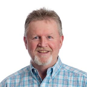
Portrait of Ron Wallace, PLS, Survey Department Manager

Why Zanevan

Ron Wallace, PLS — 40+ years of Missouri land surveying.

  • Missouri Professional Land Surveyor (PLS)
  • Career-long specialist in Missouri terrain and regulatory landscapes
  • 40+ years of local field and office expertise
  • Boundary, topographic, ALTA/NSPS, construction staking, and FEMA elevation certificates
  • Experience supporting private landowners and commercial developers on projects of every size

See full bio on the team page →

Start a Survey

Tell us what you need surveyed.

Every survey begins with a brief conversation about the parcel, the deliverable, and the deadline. We scope the work and give you a clear price before anything starts — with a focus on building lifelong client relationships, not one-time jobs.

Land surveying inquiries reach Ron Wallace, Survey Department Manager.